
Short answer: Location strategy consulting uses GIS, business requirements, and documented evaluation criteria to compare where an organization should invest, serve, expand, consolidate, or investigate further. The result should explain both which locations perform well and why.
A location decision rarely depends on one map layer. A promising site may have strong access but poor utility coverage. A large service area may reach many people while leaving a priority community underserved. A low-cost facility may create expensive travel or operational gaps. Location strategy provides a structured way to evaluate those tradeoffs.
GIS makes the geographic evidence visible, but the value comes from the process around it: a clear decision question, reliable source data, transparent assumptions, meaningful comparisons, and appropriate human review.
What is location strategy consulting?
Location strategy consulting helps an organization decide how places, facilities, service territories, customers, assets, and infrastructure should fit together. Depending on the project, that can mean selecting one site, comparing several candidate markets, planning a service network, identifying coverage gaps, or prioritizing areas for investment.
This work overlaps with site selection and location analysis, but the emphasis is broader. Site selection asks which candidate best meets the requirements. Location analysis measures spatial conditions. Location strategy connects those findings to a larger operational or investment decision.
For an overview of the analytical role, read what location analysis consultants do.
1. Frame the decision before mapping
Start with the decision the analysis must support. “Find the best location” is too vague. A useful question identifies the service, population, operating model, time horizon, geographic scope, and people responsible for the final choice.
- What decision will be made from the analysis?
- Which requirements are mandatory and which are preferences?
- Who or what must the location serve?
- Which risks require separate legal, engineering, or field review?
- What would cause a candidate to be removed from consideration?
This step prevents a polished map from answering the wrong question. It also establishes what the GIS model can screen and what must remain outside the model.
2. Separate requirements from preferences
Mandatory criteria are pass-or-fail conditions. They might include permitted land use, minimum parcel size, required utility service, an approved operating boundary, or a maximum response time. A candidate that fails one of these conditions should not rank highly simply because it performs well elsewhere.
Preferences distinguish the eligible candidates. Examples include shorter travel times, proximity to demand, lower constraint exposure, room for expansion, access to a workforce, or better alignment with existing facilities. Keeping requirements and preferences separate makes the scoring easier to explain.
3. Audit the location data
Location intelligence is only as dependable as its inputs. Before analysis, review each source for date, coverage, coordinate system, geographic detail, missing values, duplicate identifiers, and fitness for the decision. A dataset can be authoritative and still be too old or too generalized for a parcel-level conclusion.
Record assumptions and gaps rather than silently replacing unknown values with favorable ones. If utility availability has not been confirmed, label it for verification. If customer points represent billing addresses rather than service locations, document that limitation before measuring coverage.
4. Screen constraints before scoring candidates
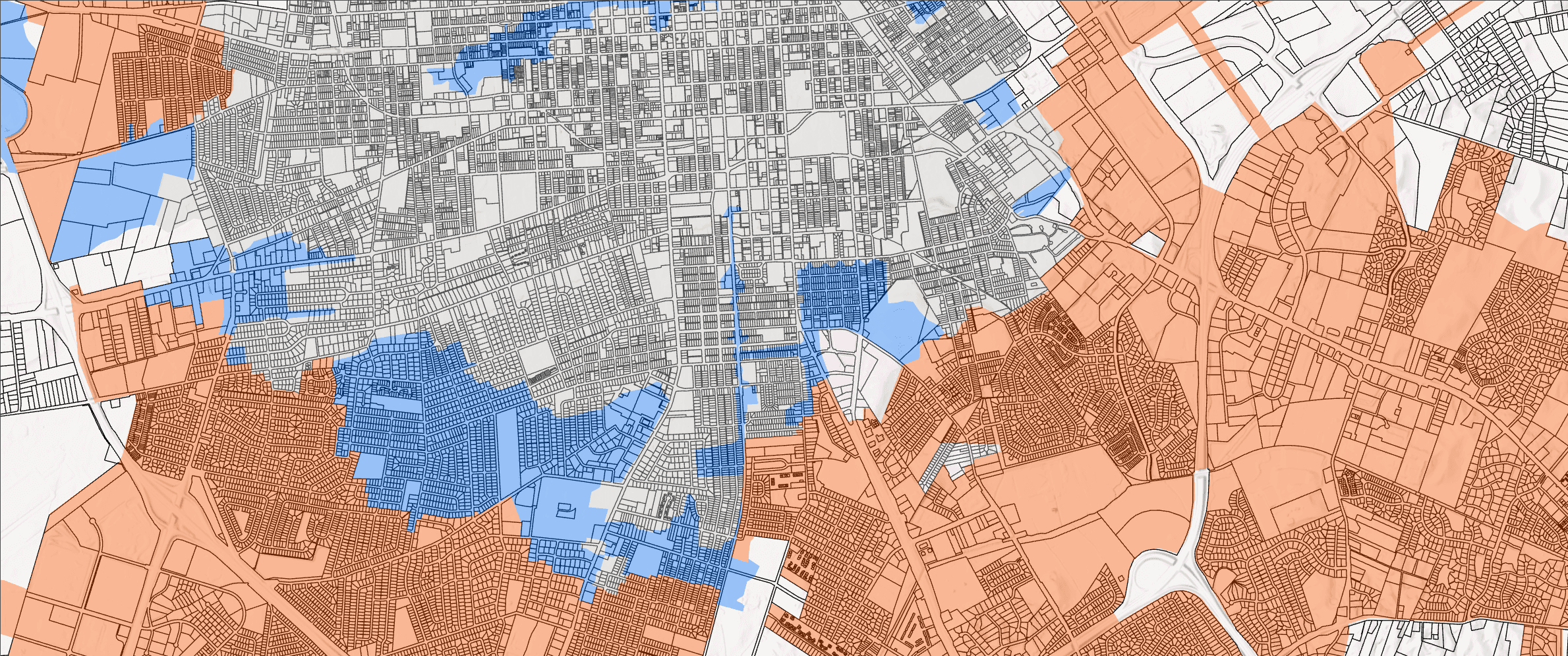
Constraints mapping can identify candidates affected by zoning, environmental conditions, flood exposure, access limitations, ownership patterns, infrastructure gaps, or other project-specific concerns. Some constraints exclude a site. Others create a cost or a question for due diligence.
Avoid treating every intersection as equivalent. A constraint touching a small part of a parcel may have a different meaning than one covering the buildable area. GIS can measure the overlap, but a qualified reviewer should determine its practical or regulatory significance.
5. Measure access and service coverage
Access analysis should match how the organization operates. Straight-line distance may be adequate for an early proximity screen. Driving time, walking access, network distance, response zones, delivery routes, or travel at different times of day may be necessary for an operational decision.
Service areas can be summarized against customers, residents, assets, incidents, demand, or priority populations. Look beyond the total reached. Two candidates with similar totals may serve different communities or leave different gaps.
6. Compare candidates without hiding tradeoffs
A weighted score can organize several factors, but it should not replace the underlying measures. Show the travel time, coverage, constraint flags, cost indicators, and other important values beside the combined score. Decision-makers need to see why two candidates differ.
Normalize measures carefully so their units do not distort the result. Document whether a larger value is favorable, how categories were scored, and who approved the weights. Do not imply that decimal precision makes subjective preferences objective.
7. Test whether the recommendation is stable
Sensitivity testing asks whether a modest change in assumptions changes the shortlist. Increase and decrease important weights, try reasonable travel thresholds, and test uncertain inputs. If the leading candidate changes under small adjustments, the correct conclusion may be that several locations need additional investigation.
Also compare the result with a simple baseline. A complex model that produces nearly the same answer as one clearly important measure may not justify its maintenance burden.
8. Deliver a decision package, not only a map
The final output should help people review the evidence and take the next step. A useful location strategy package commonly includes:
- A shortlist map showing candidates, service areas, and key constraints.
- A comparison table with original measures, flags, and ranking results.
- A methods note describing sources, dates, assumptions, and limitations.
- A record of excluded candidates and the reason each was removed.
- Recommended field checks, confirmations, or due-diligence steps.
- GIS layers or a repeatable workflow for future updates.
The recommendation should distinguish what the analysis demonstrates from what still requires confirmation. This makes the work easier to defend and less likely to be misused later.
Example: planning a regional service network
Consider an organization deciding whether to add one facility, relocate an existing one, or change service territories. A practical analysis could map current demand and facilities, calculate comparable drive-time areas, identify underserved clusters, screen candidate properties, and estimate how each option changes coverage and travel burden.
The answer may not be a single “best” site. One candidate might maximize total coverage, another might improve equity, and a third might fit the operating budget more reliably. The strategy is the documented choice among those outcomes, supported by GIS rather than hidden inside it.
When an outside location strategy consultant helps
External support can be useful when the decision crosses departments, combines unfamiliar datasets, needs an independently documented method, or requires more GIS capacity than the internal team has available. A consultant can also build the comparison workflow while leaving organization-specific policy decisions with the people accountable for them.
Before hiring, ask how the consultant handles missing data, validates sources, separates requirements from preferences, tests scoring choices, and documents the final method. The clearest proposal is not necessarily the one with the most layers. It is the one that connects each analytical step to the decision.
How CartoCodeGIS supports location strategy
CartoCodeGIS helps teams frame location questions, prepare spatial data, compare candidates, analyze service areas, map constraints, and deliver decision-ready outputs. The focus is a practical method your team can understand, review, and update.
Explore our location analysis consulting services or review additional GIS project examples.
Comparing sites, service areas, or investment priorities?
Share the decision, available data, and geographic scope. CartoCodeGIS can help turn them into a clear location strategy process.
Discuss a Location Strategy Project